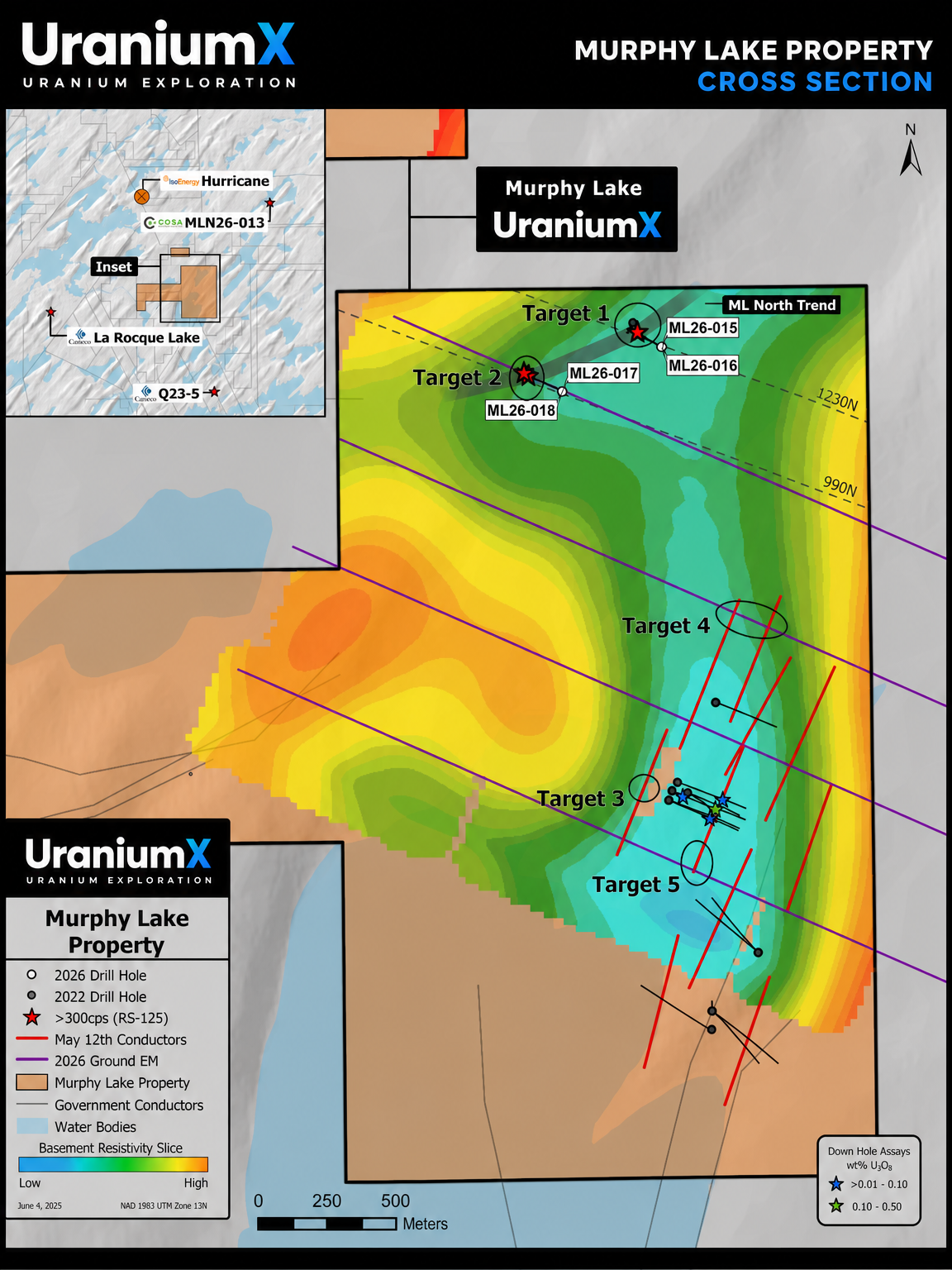
UraniumX
LOADING BASIN DATA

Claim Details

Click any claim to view details
UraniumX

Explore the Athabasca Basin

Interactive mineral claims map powered by UraniumX Discovery Corp
CSE: STMN | OTC: STMXF | FSE: Q7S
Saskatchewan
ATHABASCA Saskatoon P. Albert Key Lake
Canada
N
10 km
58.300°N · 107.000°W · z6.2 UraniumX Discovery Corp · Data: Saskatchewan Geological Survey / MARS · GeoAtlas: Gov. of Saskatchewan · Imagery: Mapbox
Cautionary note: No mineral resources have been defined on any UraniumX property. This map is for informational purposes only and does not constitute a mineral resource estimate under NI 43-101.

Don't miss the drill results

Spring 2026 drill program is fully funded. Get news releases and results delivered to your inbox.

← Back to Site
FLY TO PROPERTY
Map Style
Properties & Claims
Geology
Geophysical Interpretation
GeoAtlas (Gov SK)
Camera
Right-click drag to orbit · Scroll to zoom
Ctrl+drag to tilt · Arrow keys to pan
Pitch
Terrain 1.8x
Overlays

Disclaimers: The Company has not defined any mineral resources or mineral reserves on any of its properties. Mineralization on adjacent or nearby properties is not necessarily indicative of mineralization on the Company's properties. This page contains forward-looking information; actual results may differ materially. Technical content reviewed by Ken Wheatley, P.Geo., Chief Geologist, a qualified person under NI 43-101.

Privacy